


UTICA 04, Clark County, Indiana
About
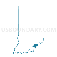
Outline

Summary
| Unique Area Identifier | 576597 |
| Name | UTICA 04 |
| County | Clark County |
| State | Indiana |
| Area (square miles) | 2.39 |
| Land Area (square miles) | 2.21 |
| Water Area (square miles) | 0.18 |
| % of Land Area | 92.59 |
| % of Water Area | 7.41 |
| Latitude of the Internal Point | 38.34984580 |
| Longtitude of the Internal Point | -85.65079640 |
Maps


Graphs
Select a template below for downloading or customizing gragh for UTICA 04, Clark County, Indiana


Neighbors
Neighoring Voting District (by Name) Neighboring Voting District on the Map
- UTICA 01, Clark County, IN
- UTICA 02, Clark County, IN
- UTICA 02 JEFFERSONVILLE, Clark County, IN
- UTICA 04 JEFFERSONVILLE, Clark County, IN
- UTICA JEFF CITY 19, Clark County, IN
Top 10 Neighboring County Subdivision (by Population) Neighboring County Subdivision on the Map
- East Jefferson CCD, Jefferson County, KY (75,440)
- Pewee Valley CCD, Oldham County, KY (36,147)
- Utica township, Clark County, IN (6,016)
Top 10 Neighboring Place (by Population) Neighboring Place on the Map
- Louisville/Jefferson County metro government (balance), KY (597,337)
- Jeffersonville city, IN (44,953)
- Utica town, IN (776)
Top 10 Neighboring Unified School District (by Population) Neighboring Unified School District on the Map
- Jefferson County School District, KY (738,704)
- Greater Clark County Schools, IN (74,124)
- Oldham County School District, KY (60,316)
Top 10 Neighboring State Legislative District Lower Chamber (by Population) Neighboring State Legislative District Lower Chamber on the Map
- State House District 71, IN (67,720)
- State House District 48, KY (57,316)
- State House District 59, KY (55,004)
- State House District 43, KY (35,580)
Top 10 Neighboring State Legislative District Upper Chamber (by Population) Neighboring State Legislative District Upper Chamber on the Map
Top 10 Neighboring 111th Congressional District (by Population) Neighboring 111th Congressional District on the Map
- Congressional District 4, KY (741,464)
- Congressional District 9, IN (729,076)
- Congressional District 3, KY (721,626)
Top 10 Neighboring Census Tract (by Population) Neighboring Census Tract on the Map
- Census Tract 507.01, Clark County, IN (5,557)
- Census Tract 75.02, Jefferson County, KY (5,339)
- Census Tract 308.01, Oldham County, KY (3,901)